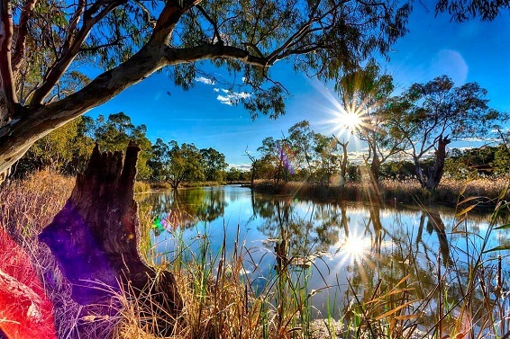
River Murray Flow Report
Stay up to date on SA River Murray flow rates, water levels, barrage operations, navigation issues and construction activities with the River Murray Flow Report.
- View current and previous River Murray Flow Reports
- Sign-up to receive a copy of the weekly River Murray Flow Report via email
Please refer to the South Australian State Emergency Service (SES) website for near real-time information on current warnings. The Bureau of Meteorology is responsible for flood prediction, warnings and advice for the River Murray in all states.
More information
Other flow updates and information
- Current SA daily water levels
- SA Water daily flow report
- SA Water daily salinity report
- SA Water daily river graphs
- Murray-Darling Basin Authority weekly report
- Real Time Water Data (DEW)
- Live river system data (Murray-Darling Basin Authority)
- SA Health water quality alerts
Bureau of Meteorology forecasts and monitoring
- SA rainfall and river conditions
- Victorian rainfall and river conditions
- NSW rainfall and river conditions
- Climate outlooks
- Climate drivers
Mapping
- River Murray inundation mapping
- 2014 flood mapping of the River Murray Floodplain
- Flood awareness mapping
Further information
High flow advice and information
In the interests of community safety, the following precautions are recommended during periods of high flows:
- Don’t drive, ride or walk through flood-affected causeways or roads.
- Be aware that significant debris is being carried downstream and may pose a hazard to water-based activities.
- When operating a boat on the floodplain or near inundated riverbanks, be aware of submerged obstacles such as trees and fence lines.
- Landholders, especially those with shacks or other structures in low-lying areas, should consider securing their property from likely rising water levels.
- The hazards associated with riverbank collapse still exist in some areas so be aware of the signs - such as cracked riverbanks and leaning trees and keep away from fenced or sign-posted affected areas.
- Regularly monitor river levels in your local area and take care not to become isolated by rising water.
- Always wear a personal floatation device on the river.
- Do not jump or dive into the river when you do not know what is below the surface.
- Camp on higher ground away from the riverbank.
- Supervise children at all times and do not allow them to play in or near fast-flowing river water.
- If in doubt, stay out.
- Listen and take action on any instructions from the emergency services - the SES, SA Police and the CFS.
- Tune to ABC local radio for community safety information.
Further information
Requests for assistance for on-water incidents or inundation of property should be directed to the SA State Emergency Service (SES) on 132 500. More information can be found on the SES website: https://www.ses.sa.gov.au/home
For up to date River Murray date, salinity, flow and water level information, visit our Water information and data section.
Details of river height and rainfall information in the River Murray within Victoria and New South Wales are available at the Bureau of Meteorology website:
The National Parks and Wildlife website will provide updates on any areas of National Parks that are impacted under a high flow. Visit their Closures and Alerts page to find out more: https://www.parks.sa.gov.au/know-before-you-go/closures-and-alerts
What are high flows?
High flows occur when River Murray flows reach 40 gigalitres per day (GL/day) at the South Australian border, with target high flows for environmental benefits being between 40GL/day and 80GL/day (Fig.2). These levels may cause water from the main river channel to flow over riverbanks, into surrounding creeks, lakes, wetlands and floodplains.
What are the effects of high flows?
High flows between 40GL/day and 80GL/day, generate system-wide environmental benefits, including keeping the Murray Mouth open, flushing salt, removing environmental debris, adjusting soil salinity levels, replenishing groundwater storage, creating breeding and feeding opportunities for water-dependant ecosystems, and providing additional water to precious wetlands and floodplains.
What are floods?
Floods can occur when River Murray flows exceed 100 GL/day (Fig.2), resulting in an overflow of water beyond the normal limits of a watercourse, and water extending over what is usually dry land. An example of this is when rivers break their banks and water covers the surrounding land.
What are the effects of floods?
While providing similar environmental benefits as high flows, major flooding such as the 2022-23 River Murray flood event, can cause damage to homes, businesses, and public infrastructure, with a lengthy and costly recovery process for river communities.
What is a River Murray High Flow Advice?
A High Flow Advice is not a flood warning, but an alert of a higher than average river current. The flow identified in a High Flow Advice is a figure that may occur, and subsequent forecasting will refine the figure.
The purpose of the High Flow Advice is to create raised alertness and monitoring in the community of the danger associated with flows in the River, and prevent unnecessary losses to the community.
Is it safe to go to the River Murray during high flows?
Yes, people are encouraged to enjoy the River Murray, while being aware of the hazards and acting responsibly to stay safe.
During high flows, T River Murray water level is higher than normal, and the flow is also faster. The main river channel may contain debris and other submerged hazards and will be harder to navigate by swimming or boat.
What is at risk of being flooded?
When the flow at the SA border is in the range of 40 to 60 GL/day, there is a small likelihood of extra inundation in the River Murray. The River channel will transport the extra flow through the locks and weirs, which causes a higher river current.
What are the flood warnings for the SA River Murray?
Flood level descriptions are based on flows at the SA-Victoria border as follows.
- Up to 40 GL/day - within the normal range, and no warnings are required.
- Above 40 GL/day - High Flow Advice is issued by DEW.
- Above 60 GL/day - River Murray towns are unaffected and a High Flow Advice remains in place. Low lying areas and floodplains become inundated and a Flood Advice - River Murray Shack Areas between Cadell and Mannum (not towns) is issued by SES.
- From 100 GL/day - a Flood Advice - River Murray is issued by SES.
- From 130 GL/day - a Flood Watch and Act – River Murray is issued by SES.
- From 200 GL/day - a Flood Emergency Warning – River Murray is issued by SES.
- The Bureau of Meteorology also issues flood warning products (warnings, watches, bulletins) complementary to those issued by the SES.
Image gallery