Managing Adelaide's Beaches

A visit to the beach is part of the Australian culture. In Adelaide people of all ages come from far and wide to enjoy a dip in the water, a walk along the sandy beach and many other activities.
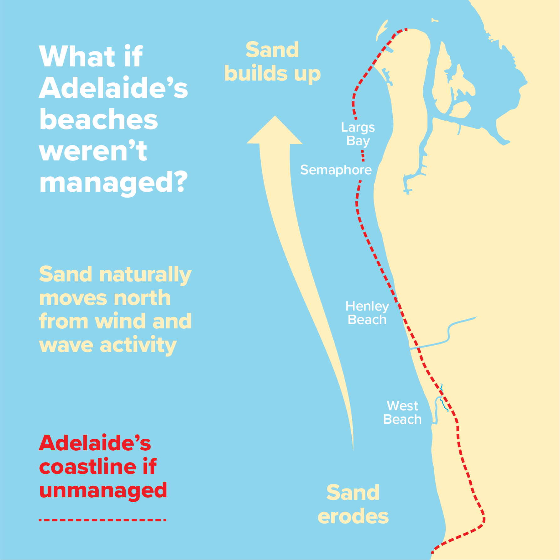
Adelaide’s coastline is one connected system with sand naturally moving northward by the wind and waves. This causes a build-up of sand on beaches such as Glenelg and Semaphore and erosion on our southern and central coast such as Seacliff and West Beach and Henley Beach South.
Did you know?
|
How sand is managed

The State Government works with local councils to manage Adelaide’s metropolitan beach system and keep sand on our beaches.
Adelaide essentially has one long beach running 28 kilometres from Kingston Park to Outer Harbor. The beaches are managed in sections or ‘cells’ to address the impact built structures have on sand movement.
Check out our video below to see how sand is managed on Adelaide’s metropolitan beaches.
|

Beach management explained for kids
How sand is monitored
We monitor the sand on our beaches in three keyways:
- Monitoring with cameras
- Monitoring with drones
- Visual monitoring
Monitoring with cameras
Beach monitoring cameras are sometimes employed to monitor the coast and support decision making. The cameras capture time sequence images useful for analysing beach operations and changes. The data gathered helps to guide coastal management decisions and complements annual beach survey data collected by the Coast Protection Board.
The images are stored securely in accordance with state government data requirements. The images are only used for internal purposes by the department and are not published.
Coastal monitoring cameras have been used at Glenelg, Largs Bay and West Beach.
Monitoring with drones
Using drones is another method employed to monitor the coast to support decision making. On a clear day a drone equipped with a high-resolution camera can capture an aerial view of the coast: the beaches, dunes, sandbars offshore and the movement of sand in the nearshore environment. This form of monitoring has been very useful over the past few years while the external sand has been delivered to West Beach. The most recent drone footage can be viewed here December 2022 drone footage
Drones equipped with topographic LiDAR sensors are also used to capture highly detailed elevation data of parts of the coast. The Coast Protection Branch continues to explore new and emerging technologies that can support the existing survey and monitoring methods.
Visual monitoring
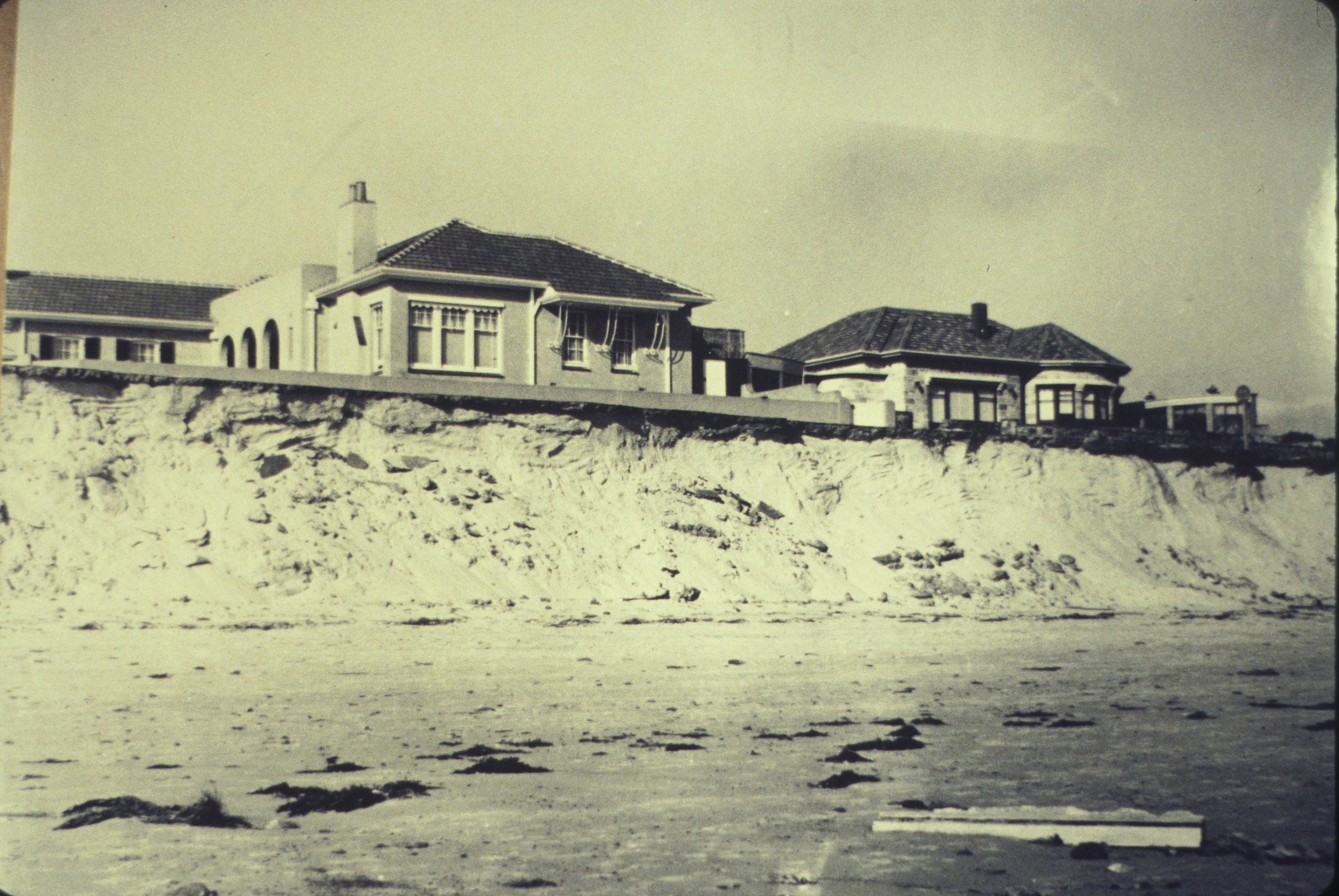
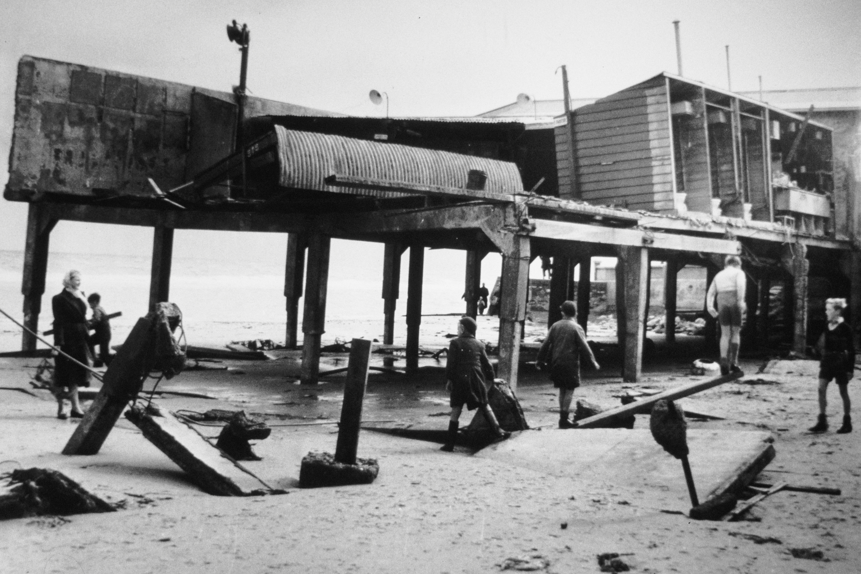
Visual monitoring also helps with decision making. It involves inspecting the coast regularly and especially after storms and high seas, or while beach replenishment operations are underway. Photographs are taken at set locations and are useful for comparison and observing short-term changes in beach height or dune position.
The set of pictures below show how visual inspections from a set location help to observe short-term changes in beach height.


Image gallery