Patawalonga Lake System
About the Pat
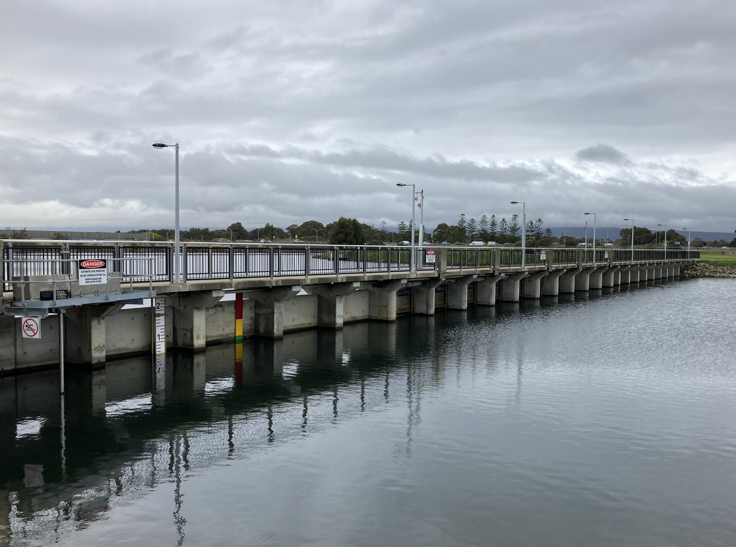
The Patawalonga Lake System, locally known as ‘the Pat’, is a critical piece of urban infrastructure in managing stormwater and flood risk on the metropolitan coast of Adelaide.
Several creeks and drains flow into the Pat, including the Sturt River, Brown Hill Creek, Keswick Creek, Patawalonga Creek, and the Airport drain. These waterways flow from a catchment area of more than 230 square kilometres, with most water coming from the Sturt and Brown Hill Creek catchments.
The best-known component of the system, the Patawalonga Lake, is a 1.6km artificial ribbon lake that runs parallel to the coast, 9 kilometres west of the Adelaide CBD. This main lake is designed to support a healthy marine environment, while diverting urban stormwater into the Gulf of St Vincent via the Barcoo Outlet.

Recreational features of the Pat
- Popular for boating, fishing, kayaking and other water sports.
- A 145-berth marina offers mooring for boats and access to the Gulf via a lock managed by the City of Holdfast Bay.
- A walkway circuiting the Pat is popular with cyclists and pedestrians, with infrastructure on the southern end providing a connection for foot traffic between North Glenelg and Glenelg.
- Dolphin sighting is common as dolphins often visit the lake to feed.
If you have any questions or concerns about the Patawalonga Lake System operations, you can contact our team directly at dewplsoperationsandmanagement@sa.gov.au
To view current water levels in the Pat, visit WaterConnect.
While the Pat plays a key role in managing stormwater, the quality of stormwater is also important. Find out how we stop rubbish from entering our waterways and what you can do to help at Green Adelaide.
You can subscribe here for notifications from Patawalonga operations and maintenance.
Funded by Green Adelaide.
Image gallery